Featured
GTFS data · Territory · Transparency
GTFS platform for network editing, validation, travel times, isochrones, and AI-assisted reports — the data backbone for mobility policy and open data.
Featured
Passenger app · Branded digital channel
Official traveler app with accounts, notifications, and AI-assisted planning on your network — not only third-party map apps.
Totems · Stations · Intermodal hubs
Information totems and companion mobile experience: routes, places, 3D maps where useful, voice and text assistants, and CMS-driven content.
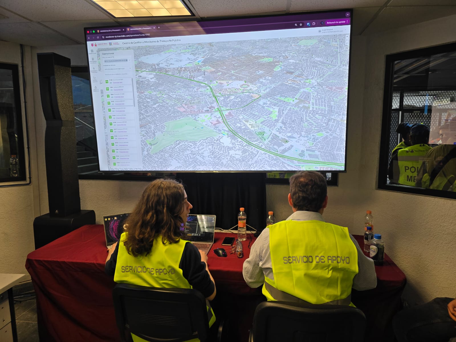
Control room · Real-time operations
Monitoring room for operators and policy teams: live operational map, operator tools, notifications, and AI-assisted reporting.
Field teams · Drivers · Survey
Mobile app for field mapping and drivers: operational capture, routes, and survey workflows tied to the official network.
Featured
Transfer hubs · GTFS · Document workflows
Park-and-ride and transfer-site operations aligned with GTFS: document scanning, operational flows, and data tied to the authority network.
Taxis · Inclusion · Institutional mobility
Official digital platform for traceable trips, transparent fares, on-demand and voucher flows, and channels for users without smartphones.
Hazardous waste · Traceability · Compliance
Regulated hazardous waste program: central backend, Cartolab (web/map admin), user portal, and Astrolabus (mobile operators on route or at site).