Transit Data available in Google Maps = Benefits for the community
Millions of people use Google maps to plan their trips on public transport at no cost
👤 Authors: Jorge Arreola Ruiz
🗓️ Thu May 30 2024
The importance of the role that public transportation plays in the sustainability of cities can be seen very clearly in the famous image that I share below, even more so if the means of transportation is zero emissions. If we see the comparison between the number of people that can travel in a public transport unit against the same number of people, one for each vehicle, the image says it all, less road congestion, less pollution, less spending, less stress, less…
Credits: Australia’s Cycling Promotion Fund
You will surely have more things to add to the list. We will not delve into it for the moment, the truth is that at some point, our cities will run out of space for so many vehicles, even when they are electric or hybrids with little or no emissions. Anyway… It will be easy to conclude that Public Transportation will be the solution or a lifeline to mobility in the 21st century, as stated by H.E. Dennis Francis, United Nations General Assembly President “Transportation is a lifeline, connecting communities and markets.”
Modernity is reaching all areas of human activities. In Public Transport, we are already seeing the transition from fossil fuel engines to electric or hybrid, the use of sensors for autonomous driving to urban trains without physical metal tracks… The technological advance that exists until today is truly surprising. However, this phenomenon does not occur in all countries or all regions; it occurs mainly in large and modern cities.
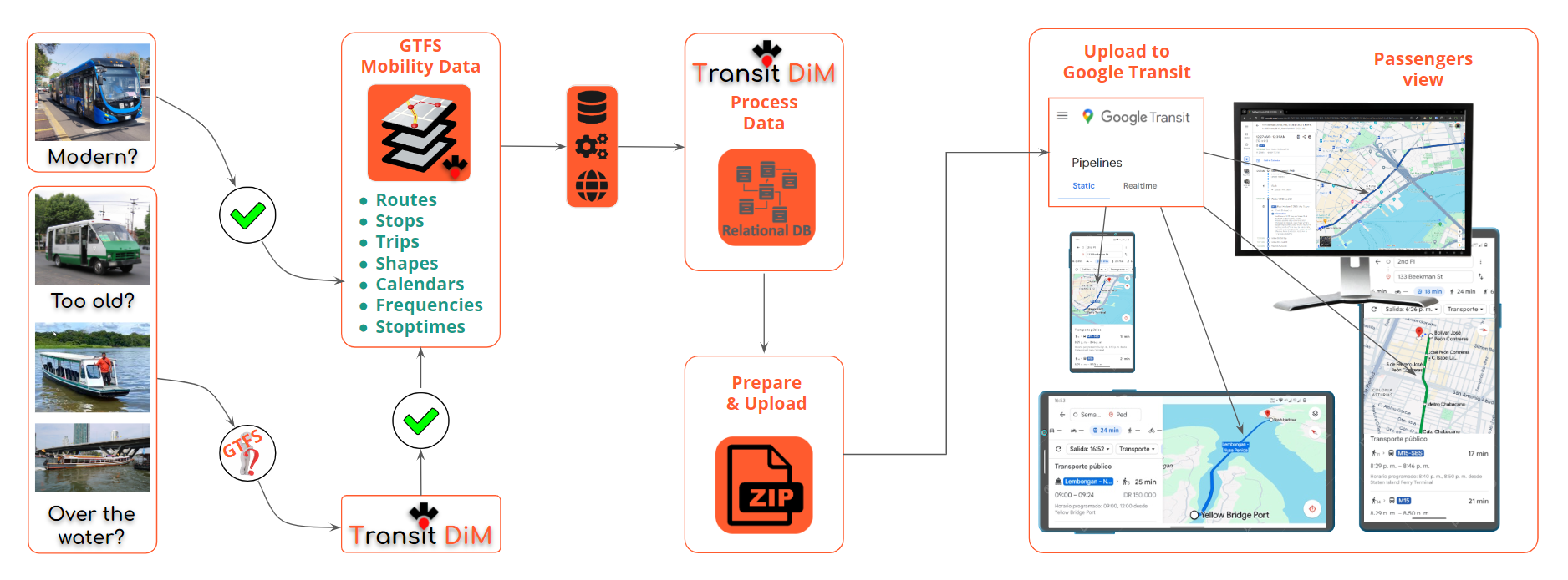
On the other side of the coin, public transportation, for many years, has maintained its same structure and operations scheme, especially in emerging economies where in some cases its units are already old and obsolete, and other specific regions move passengers over the water from standard boats to fast boats.

Inspired by this phrase from H.E. Dennis Francis, on connecting communities and markets, from the point of view of a public transportation agency, whether large, medium or small, this widely used tool will further connect even more passengers through a partnership with Google Maps through GoogleTransit. The Agency will only have to provide mobility data so that the routes, stops, operation calendars, etc. can be displayed on its world-renowned and super advanced platform to passengers, it is an opportunity that should not be missed
After this preamble… The topic that I would like to address in this post is that of Trip or Route Planners… Surely you have already used Google maps to plot a route from point A to point B, however, the Public Transportation option shows as an option not available in route search results in many cities around the world, this is because Google does not have the information on those routes. To make this possible, Public Transportation Agencies have to upload their route information in GTFS format to Google Transit through a partnership between both parties.

The transformation that we talked about previously at the beginning of this post will undoubtedly be slower in some places, however, updating to new technologies is not only about transformations in mechanical or motor issues, but also in adaptation to mobility data, trip planners and mobile apps.
Millions of people around the world use Google maps to plan their trips at no cost using the public transportation option, in addition, the publishing of the routes for the transportation Agency does not have it either, this is something that is not common these days!. Creating or producing GTFS data will have an initial cost for the Agency and with that product they will be able to publish their routes on the Google Transit platform. The proper use of this platform will help connect the Agency with its public transport passengers, benefiting business growth.

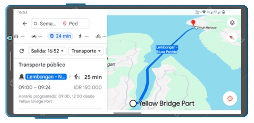
Let’s talk a little more about Google Transit, this API offers the facility to plan journeys in Google Maps so easily that passengers only have to select the origin, destination, day and time of departure in the app and multiple schedule options immediately appear, modes of transport, fares, travel times, arrival time, among others. Furthermore, something very important to mention is that one of the data that is visible to the passenger is the link to the Transportation Agency’s website, through which the passenger can visit the website and there they will find out about the services offered, connecting them to the landing page to hook them to the marketing strategies implemented.

It does not matter the size of the Public Transportation agency, its age or if it transports passengers over water. Google Transit is open to providing passengers with as much mobility data as possible around the world. As I mentioned before, and I would like to emphasize it, Google Transit does not have an economic cost for the transportation agency or for the passenger, its income is from advertising, so we should not worry about this issue. Any company that offers public transportation services and operates with fixed routes and schedules can participate in Google Transit. In addition, they have recently incorporated the functionality of supporting long-distance routes in 15 countries.
Like many people, I have seen how over the years this technological revolution is advancing and evolving more rapidly, now we use smartphones to plan our public transport routes, who knows what type of devices there will be in the next 20 or 25 years, What I can dare to comment on is that public transport and mobility data will be present. It will be up to the new generations to adapt them so that they can continue serving passengers. If you consider this to be a debatable point, I invite you to comment to exchange points of view. I thank you very much for your attention.
